The benefits of satellites are far-reaching and versatile. They can improve productivity on farms, locate people stranded in disaster zones, and even track sports performance
Published online 25 May 2017
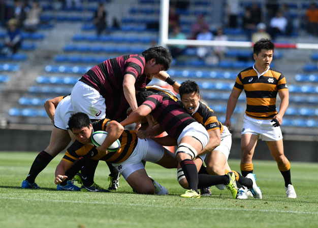
Satellite technology is helping rugby players improve their sports performance.
© Keio University Rugby Football club
Naohiko Kohtake's research area of space once seemed among the least practical realms. But his work solves real-world problems for everyday people working on the land, looking for safety, or scoring their next try.
Kohtake is a system design scientist at Keio University, who thinks big about how satellites can collect, analyze, and even send out data. "The key is a holistic view," says Kohtake, who is also an adjunct associate professor at the School of Engineering, Asian Institute of Technology. "Many people focus on specific areas, but we focus on optimization, system thinking, and modeling to design a sophisticated, merged system."
A striking example of this is Kohtake's disaster management systems. He has used location data collected from mobile phones and taxi GPS to analyze how people behave during disasters across Asia, such as the 2011 Tohoku earthquake and resulting tsunami. "Data is useful for finding social issues," he says. "We can understand the program underneath ― the human mind."
While developing these systems, Kohtake realized that satellites could also help with communication in the confusion of a natural catastrophe. "After a disaster it is difficult to maintain contact and communicate messages to people," he says.
Taking advantage of the fact that Japanese navigation satellites can broadcast messages directly to the GPS receiver built into mobile phones, Kohtake and students designed an app to get location information about designated meeting points or safe routes to people in disaster zones. Already, the system has been successfully trialed for bushfires in Australia and for tsunami warnings in several Asian countries.
This example, like many of Kohtake's diverse research areas, grew out of his passion to broaden the uses of satellite data.
"Nearly every university has a program on how to build rockets and satellites, but few have courses on how to use satellite technology," he says. To address this, Kohtake leads the Geospatial and Space Technology Consortium for Innovative Social Services (GESTISS), a collaboration set up in 2012 between several universities in Asia, including Keio University's Graduate School of System Design and Management. Every year, GESTISS organizes tutorials, seminars and summer camps for 100 students across Asia and inspires them to think about how to employ satellites for social good.
Kohtake's GESTISS students, in collaboration with Malaysian researchers, traveled to palm plantations in Malaysia, where they revolutionized the labor-intensive planting practices. Using satellite and drone data to create three-dimensional maps, they developed an app that enables a single person to calculate the optimal planting position ― far more efficient than the traditional team method using long wires.
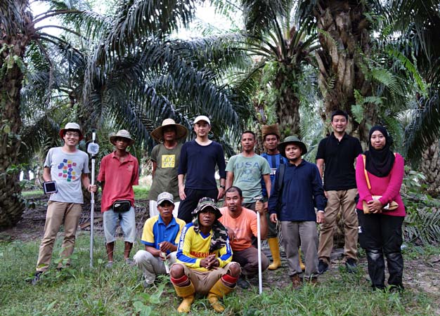
A team of students trained by Naohiko Kohtake have used satellite and drone data to improve the productivity of palm farmers in Malaysia.
© Naohiko Kohtake, Keio University
As well as rural settings, Kohtake is working in the most densely populated areas of the world. The obstacle of tall buildings can cause errors in navigation systems of several meters, which could lead to disaster for driverless cars. Kohtake's solution is to develop a navigation app that uses data from multiple satellite networks ― the Japanese Quasi-Zenith Satellite System, the Chinese BeiDou and the United States Global Positioning System (GPS) ― and is accurate to within a meter.
Kohtake's positioning system is so precise that he is now using it to benefit his favorite pastime, rugby. Each player is equipped with a small tracking device, enabling them to download a record of their every movement on the field, to analyze and improve their performance.
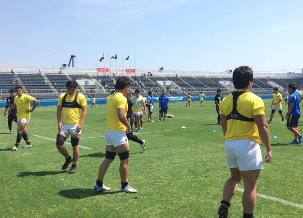
Wearable sensor technology (black vests) can be used to track a player's movement on the field.
© Keio University Rugby Football Club
This revolution in sport science, believes Kohtake, who is an adviser at the Japan Sport Council, will also give professionals a career path when they retire from sport.
"Top athletes interested in their performance data develop analytical skills, which are good not only for sport but also can help them move to other domains."
References
- Choy, S. et al. Application of satellite navigation system for emergency warning and alerting. Computers, Environment and Urban Systems. 58, 12-18 (2016). | article
- Okami, S. & Kohtake, N. Fine-scale mapping by spatial risk distribution modeling for regional malaria endemicity and its implications under the low-to-moderate transmission setting in western Cambodia. 11, PLOS ONE e0158737 (2016). | article